Utilities#
Additional tools to help collect, view and process risk data.
Merge tiles#
Large raster datasets often comes as a collection of regular tiles. In order to run the raster analysis offered in our tools, they often need to be merged into one file. The function is provided as jupyter notebook you can download and run on your python environment. Please refer to the main codebase setup.
Fetch WSF 2019 and resample as 100 m#
WSF offers 10 m binary maps of artificial land cover. In order to run the raster analysis offered in our tools, the data are automatically resampled to 100 m and mosaiced together for a country extent. The function is also provided as jupyter notebook you can download and run on your python environment.
Mapping in jupyter notebook#
Mapping geospatial data doesn’t strictly require GIS programs. Some decent results can be achieved with Folium and similar libraries. An example is provided as jupyter notebook you can download and run on your python environment.
EMDAT dashboard#
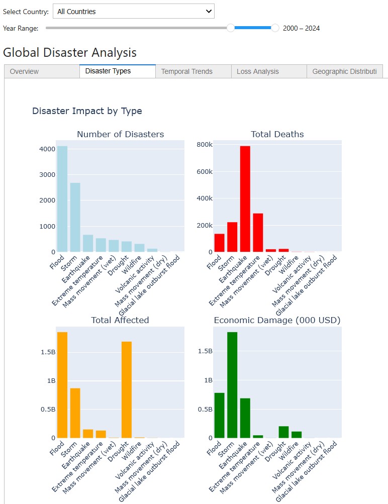
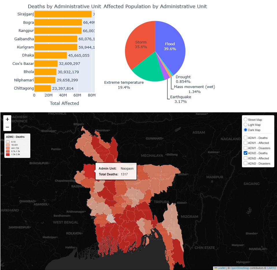
Dashboard created from EMDAT dataset, summarising global and country statistics for natural hazards. See the jupyter notebook.

Fig. 46 EMDAT dashboard notebook#

Fig. 47 EMDAT dashboard notebook#
External tools#
Additional tools to help collect, view and process risk data.
Name |
License |
Description |
Purpose |
|---|---|---|---|
GNU |
GIS software |
Open, plot, manipulate geodata |
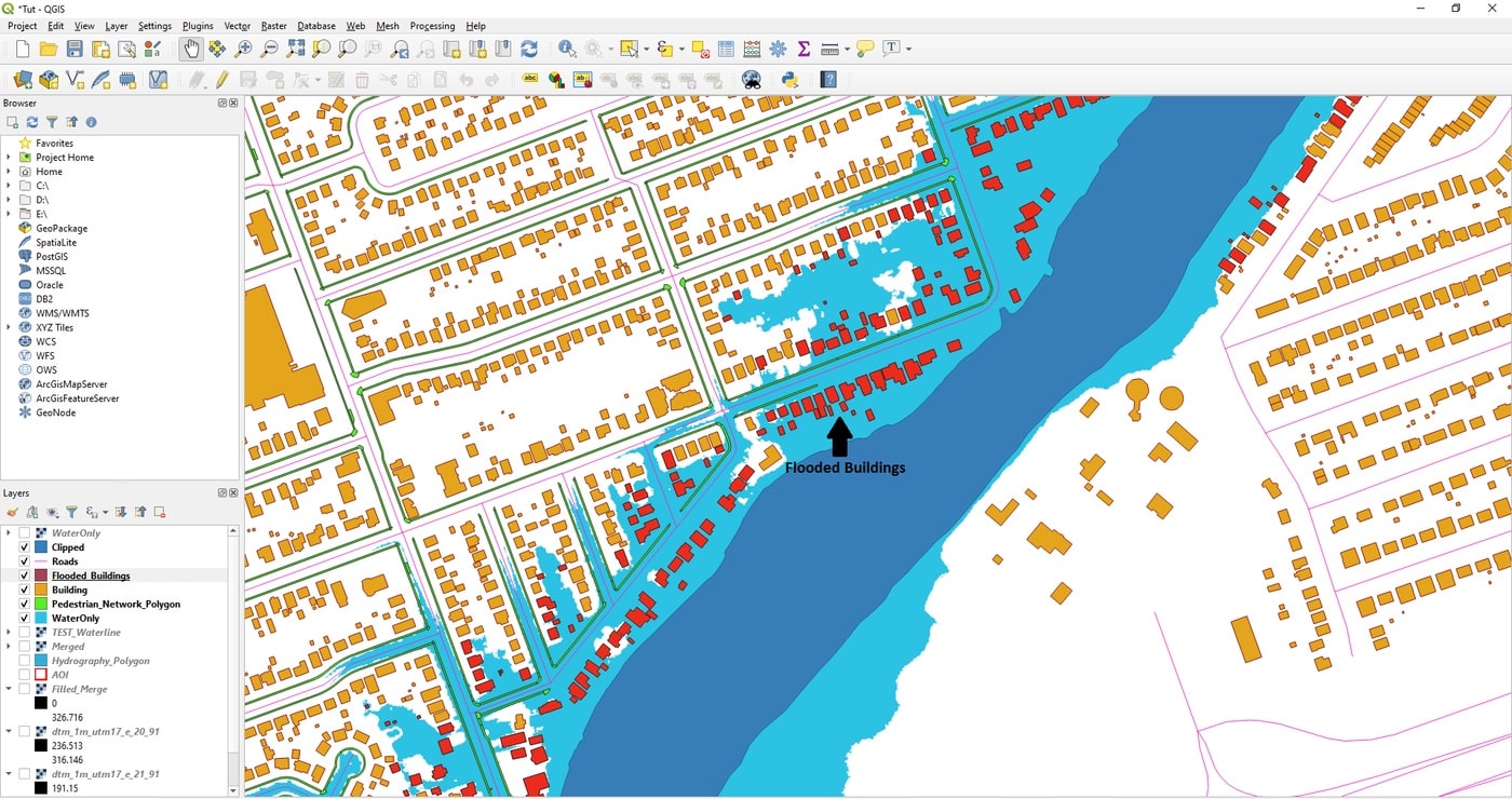
The most commonly used software for geodata visualization and processing is QGIS, which comes with a rich documentation.

Fig. 48 Example of QGIS project#
